GPT E2E
- Duração: 13 Dias (Aproximadamente)
- Localização: HALLS GAP, VIC
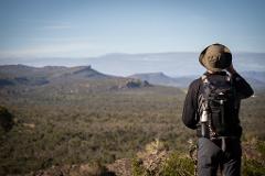
The GPT E2E expedition is not for the faint-hearted. It’s 13 days on the trail that will test your stamina and resolve with every peak and turn opening a new view that will inspire you to keep going. This expedition will cover the entire length of the GPT from north to south, walking every day. With the exception of the 4th night in Halls Gap, we’ll stay in the on-trail hiker camps in lightweight hiking tents experiencing for ourselves the constantly changing personality of the Gariwerd Landscape.
Over the course of the expedition, we will witness numerous changes to the environment, experience different levels of remote access and gain an in-depth understanding of the land. The northern and central sections of the trail have relatively good access and amazing facilities at campsites, while the wild central section is much more remote with limited access and shelter leaving you more exposed to the will of the mountains.
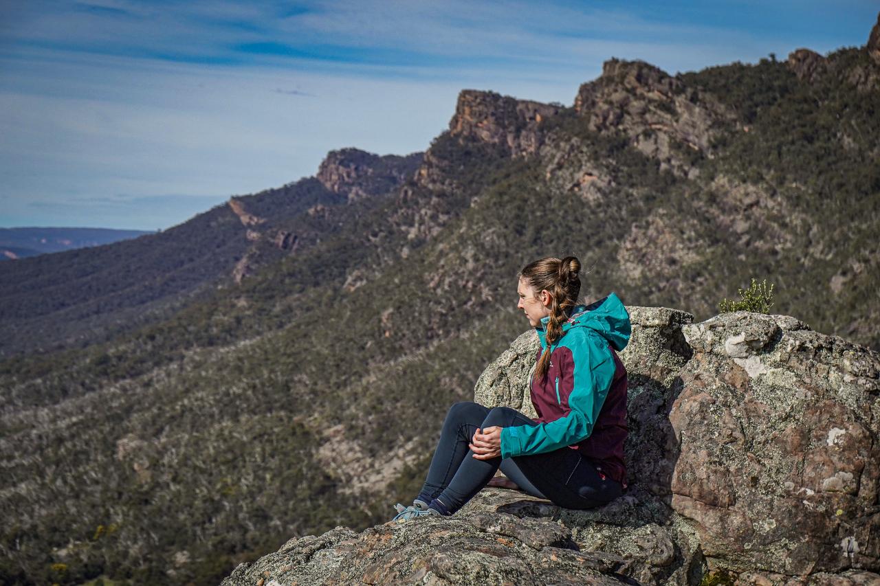
We'll begin our journey at the main GPT Trailhead at Mount Zero, climb Mount Staypleton and then continue southward for 13 days along the spine of Gariwerd until we reach Dunkeld. Each night at our hiker camps, we will rest, enjoy a freshly cooked trail meal and sleep under a blanket of stars. No matter your level of hiking experience, our passionate local team will be on hand to guide and support you through this journey exploring their backyard.
Itinerary summary
Day 1: Briefing at our Hiker HUB in Halls Gap, transfer to the trailhead and walk N1 - Mount Zero to Barigar hiker camp.
Day 2: Hike N2 - Barigar to Gar.
Day 3: Hike N3 - Gar to Werdug.
Day 4: Hike N4 - Werdug to Halls Gap.
Day 5: Hike C1 - Halls Gap to Stoney Creek.
Day 6: Hike C2 - Stoney Creek to Barri Yalug.
Day 7: Hike C3 - Bari Yallug to Duwul.
Day 8: HIke C4 - Duwul to Durd Durd.
Day 9: Hike C5 - Durd Durd to Yarram
Day 10: Hike S1 - Yarram to Wannon
Day 11: Hike S2 - Wannon to Djarji-djawara
Day12: HIke S3 - Djarji-djawara to Mud-Dadjug
Day 13: Hike S4 - Mud-Dadjug to finish in Dunkeld. Transfer back to Halls Gap.
Day by day
Day 1 - N1 - 12.9 km - ⬆440 m - ⬇460 m
Meet your guide and the expedition team at the Grampians Peaks Walking Co Hiker Hub in Halls Gap. After a briefing and gear check, a bus transfer will take us to the beginning of the GPT at the Mount Zero picnic area. The heart rate will rise quickly as we ascend ‘Flat Rock’ and then again when we get to the top and get our first world-class viewpoint - just 10 minutes in!
We’ll descend and navigate our way through the Stapylton Amphitheatre before skirting our way around and up Mount Stapylton itself. For the footsure and brave, there is a short scramble to the summit to gain 360-degree views and a sneak peek of the next day's walk in the distance.
After a fresh trail lunch, we’ll head southwards along the mostly high ground before descending into a valley and reaching Barigar Hiker Camp. After settling in we can take a short side trip to visit the camp’s namesake Barigar Falls.
Day 2 - N2 - 12.9 km - ⬆615m - ⬇113m
We’ll begin our day with a hearty breakfast and then depart camp. Our first steps take us along the base of the Rock Wall, an impressive several-kilometre-long escarpment hidden away in a valley. As the cliff line reduces, we begin to ascend its ridge to cross over into Roses Gap.
Ascending the lower slopes of Gar (Mount Difficult) we will find and begin to follow a small, seasonal and rainfall dependent watercourse. Over the next few km, we will witness this watercourse cascading over a series of falls, each one more spectacular than the last.
After we reach the top of the last waterfall, we’ll head towards the ‘Pacific Ocean Wall’ - a cliff ‘as big as the pacific ocean’ and ascend its flank via a superbly built stone stairway and continue climbing up to Briggs Bluff. With most of the ascent completed, from here we traverse our way along the high ground before arriving at Gar Hiker Camp and its breathtaking views.
Day 3 - N3 - 15 km - ⬆521m - ⬇462m
An early start this morning as we head up to the summit of Gar for a sunrise like no other. We’ll then return to camp for breakfast and then depart on the day’s journey.
We will sharply descend the eastern slopes of Gar, cross the northern end of the Werdug (Wartook) Basin and ascend the ridge of the eastern flank of the Mount Difficult Massif. Continuing south along this high ground we will eventually reach Werdug Hiker Camp with stunning views overlooking Lake Wartook and a clear line of sight all the way back to the top of Gar where we stood that morning.
Day 4 - N4 - 10 km - ⬆33m - ⬇587m
We will continue along the eastern flank of Mount Difficult and slowly tip over and descend towards the town of Halls Gap. On the way to town, we’ll head out to the end of Chautauqua Peak for an incredible view down the valley before finishing our descent all the way into Halls Gap. We will walk all the way to our night’s accommodation where we can shower and freshen up before enjoying a nice dinner out on the town.
Day 5 - C1 - 12.2 km - ⬆693m - ⬇229m
After breakfast, we’ll depart Halls Gap and farewell the comforts of civilization. This is the last time we’ll see a town until we reach Dunkeld in 8 days' time. Winding our way up the Wonderland Range we will pass iconic sites such as Venus Baths, Grand Canyon, Silent Street and the Pinnacle. After a bit of traversing some high ground, we’ll pop over and descend to the saddle between the Wonderland Range and Mount Rosea. It is then a gentle climb up Mount Rosea’s northern shoulder to the stunning Stoney Creek Hiker Camp.
Day 6 - C2 - 13 km - ⬆422m - ⬇710m
This morning starts with an exciting climb over some really interesting terrain. Passing the Gate of the East Wind we will reach the summit of Mount Rosea at 1009 m above sea level. After a long descent into the valley, we leave the Serra Range by crossing Grampians Tourist Road and begin our ascent towards Mount William. Luckily, most of that is saved for tomorrow as it's only another 1.2km to Barri Yalug, our first ‘backcountry hiker camp’ - more remote hiker camps with limited shelter. The next 5 nights of our expedition are in backcountry camps and will be a little more exposed to the elements. It’s the necessary cost to pay to experience some of the most remote and wild parts of the Gariwerd landscape.
Day 7 - C3 - 13.2 km - ⬆806m - ⬇316m
The day starts with a short, steep descent out of camp to the Barney Creek crossing at 320 m above sea level. A short flat stretch will give us time to get our minds ready for the longest continual climb anywhere along the GPT. From Barney Creek, we ascend more or less continuously until Redman Bluff at 1017 m above sea level.
This long gradual climb takes us from bushland to large open rock areas. Along the way, we’ll see parts of an old aqueduct system that used to feed water to nearby towns before the construction of Lake Bellfield. Passing some of the ‘Seven Dials’ we’ll continue on to finally reach Redman Bluff and take a well-earned rest before descending to a saddle and then a final gentle climb to Duwul Hiker Camp.
Day 8 - C4 - 14.5 km - ⬆679m - ⬇720m
Today we will walk along one of the most exposed sections of the GPT and experience its highest elevations. Starting by climbing Mt William - the highest peak in all of Gariwerd at 1167m - we will then head south and down to Boundary Gap at 878m which separates Mt William from the Major Mitchell Plateau. This descent and ascent contain some of the most challenging terrains on the whole GPT.
Once the trail reaches the plateau, it undulates across rocks and steel mesh walkways. Passing First Wannon Creek we will reach Durd Durd, the highest point on the plateau. Marked by a rock cairn, this point is at a height equal to Mt William, 1167m.
We will continue south to Banksia Hill at 1103m, across the Banksia Ridgeline and follow the trail as it hops across large boulders before descending to open grassy woodland, reminiscent of an alpine meadow. While Durd Durd Hiker Camp is much more sheltered than most of the day’s walk, it still sits at 855 m above sea level and is one of the highest camps on the GPT. Durd Dur and Duwul Hiker Camp are the most likely to receive snow in winter and even spring.
Day 9 - C5 - 12km km - ⬆456m - ⬇685m
A new landscape unfolds as we descend from the highest parts of the Mount William Range and continue to traverse southward, down into sheltered woodland valleys. Passing through previously untracked areas of the lower Mt William range, it offers up some of the most rugged ridgeline rock walking and views of the incredible Serra Range to the west. This section is fantastic for late winter and spring wildflowers. Watch for the red “spider flowers” of Flame Grevillia which typically bloom between April and November. To the east is farmland, scattered lakes and wetlands – important habitat to wildlife, including threatened species such as Australia’s largest flying bird, the Brolga. This ridge walking leads us over the day to Yarram Hiker Camp to rest up for the night.
Day 10 - S1 - 11km - ⬆313m - ⬇588m
Today we traverse the last ups and downs of the Mount William Range, and then enjoy a long flat(ish) walk passing through ancient old-growth forests and lower swampland plains with stands of native Oyster Bay Pines (Callitris rhomboidea) along the way. We will take in views of farmland, countless swamps, lakes and wetlands to the east and south-east and the dramatic Serra Range to the west. We will climb the last little blips of the Mount William Range and settle into Wannon Hiker Camp for the night in a reclaimed farmland gully.
Day 11 - S2 - 15.6km - ⬆550m - ⬇427m
We will begin walking through incredible open grassland on a combination of gentle trails and steel boardwalks. The trail winds through large areas of Xanthorrhoea australis, swampy river flats and open heathy forest. Much of the landscape here feels very old worldly - almost Jurrasic. The thick understory provides important habitat for threatened small mammals such as the Long-nosed Potoroo, Southern Brown Bandicoot and Heath Mouse. Shortly after passing the Griffin Fireline we will cross back over the Grampians Tourist Road and climb through the incredible forest back onto the Serra Range. Saddles of old-growth forest, sheer eastern faces and expansive views to the western Victoria Range will bring us to Djardji-djawara, our second last hiker camp on a small rocky knoll.
Day 12 - S3 - 8km - ⬆583m - ⬇481m
From Djardji-djawara we cross Cassidy Gap and begin up a short but spicy trail to Signal Peak. With varied terrain from steps to boulders, this climb should not be underestimated. Signal Peak is one of the great peaks of the Serra Range that prior to the construction of the GPT never had a trail leading to the summit/ Yet from the summit we will get one of the most spectacular vantage points to view Mount Abrupt in the early morning light. Our journey continues south, dropping down from Signal Peak to a beautifully forested long saddle before a gradual and eventually abrupt climb up the slopes of the aptly named peak. Walking through the forested areas and exposed ridgelines of the southern Serra Range and reflecting on the vast difference in vegetation that we have experienced on this walk really attests to the distance we have travelled. After summiting Mount Abrupt we will descend to Mad-dadjug Hiker Camp on its southern shoulder.
Day 13 - S4 - 14km - ⬆501m - ⬇770m
For our last morning on the trail, we will enjoy a quick bite and a pot of coffee before taking off pre-dawn to descend carefully and steeply, from Mt Abrupt, passing a reservoir and then climbing over Bainnggug (the Piccaninny) to catch the sunrise and breakfast. When we’re ready to continue, we will cross Victoria Valley Road and begin the final climb of the GPT over Mt Sturgeon (Wurgarri). Mt Sturgeon towers over our destination - Dunkeld - as well as offering stunning views in all directions. The landscape reveals stories of country. Looking northward we can see the sedimentary sandstone of Gariwerd and draw a line with our finger along our path going back in time over the last 5 days that are visible. To the south, basalt lava flows over volcanic plains. Volcanoes nearby at Budj Bim National Park and Mt Gambier are only 5000 years old, while the oldest dated Aboriginal rock shelter in Gariwerd is 22,000 years old. We will complete our journey by steeply descending into farmland below and wandering through open old-growth Red Gum woodland to arrive at Dunkeld. After a celebratory lunch, we will load onto our private transport and transfer back to Halls Gap.
Who is this program for?
Our GPT E2E Expedition is for keen hikers that are looking to complete the entire Grampians Peaks Trail in a single continuous journey - multiple days, start to finish without leaving the trail - while enjoying the benefits of walking with and learning from an experienced local guide and with a lighter load on their back. While we take care of all the group equipment (cooking equipment, food etc) you will need to be capable of carrying your personal clothing and sleeping bag, approximately 10-12 kgs. Over the course of the expedition, there will be 2 opportunities to have a bag of fresh clothing swapped in/out to reduce the load you need to carry.
If you are looking for a slightly shorter trip or are keen to complete the entire GPT over a number of visits, check out our Expedition programs.
If you like the idea of a shorter multi-day expedition but prefer the idea of a real bed over a tent, check out our Northern Huts Walks!
If you like creature comforts like a hot shower at the end of each day and walking pack free - check out our Grampians Luxe programs!
Departures and private groups
Do you have a group? Don't see a departure date that suits? Contact us to discuss a custom or private departure.
Inclusions:
Qualified and experienced local guides/campsite hosts.
11 nights in lightweight hiking tents at GPT hiker camps - twin share.
1 nights accommodation in Halls Gap on night 4 - twin share
Fresh and healthy camp cooked meals.
All meals on the trail.
Any required transfers.
Group safety equipment such as a first aid kit and satellite phone.
Exclusions:
Personal clothing and equipment (including backpack, mattress and sleeping bag).
Personal medical and evacuation/ambulance insurance - highly recommended.
Meals in towns.
Accommodation before and after the hike.